Naha Port and its Neighboring Ruins
History
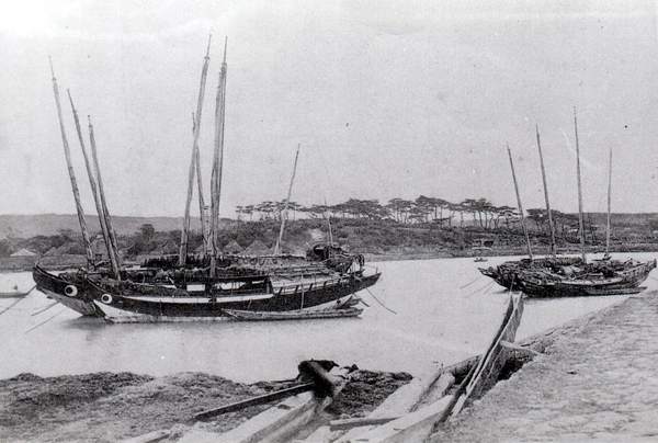
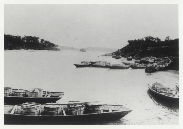
Naha Port has an old and glorious history, having served as the main entrance to Ryukyu Kingdom, since the 14-15th centuries.
Basic information
- Address
- 900-0035 2 Tondou-cho Naha Okinawa Naha Ferry Terminal harbor side Entrance/Exit
- Parking
- Toll parking available.
- Access information
- About a 15-minute walk from Asahibashi station, and from the Naha bus terminal.
Additional Information
- Academic information
- Naha Port has an old and glorious history, having served as the main entrance to Ryukyu Kingdom, since the 14-15th centuries. During the great trading time, Ryukyu Kingdom developed trade with China, Korea, and Japan; as well, the Ryukyu Kingdom became the largest trading area in East Asia. Since then, Naha Port has served as the primary port of Okinawa and has developed to the present. Therefore, there are many famous spots such as historic sites and rich natural scene in the area of Naha Port.
Both history and nature merge to form a landscape representative of Naha. This landscape was completely changed by the Battle of Okinawa, but one is still able to see the general outline of the landscape depicted by the Royal government drawings completed during the Meiji era.
■Mii Gusuku
This is a stronghold on the north shore of Naha Port, from Tundousachi through Kobashi, Ohashi, Okinodera, Nakanohashi, Naka-Mii Gusuku, Tsukibashi then, to Mii-Gusuku. It is thought to be established in King Shosei's time; however, others think is was established in Daiichi Sho-shi's time. Mii Gusuku is paired with Yarazamui Gusuku on the south shore.
■Rinkaiji-Temple
Known as Okinotera, this temple was located on top of the cliff between Tundozaki and Mii Gusuku. Rinkaiji was a Buddhist temple of Shingon-shu which was built before the Shimazu invasion. The temple also enshrined Kumano-Gongen (Shinto's God). When the port construction took place in the 41st year of Meiji era (1908), Rinkaiji was moved to Kakinohana, and the Gongen was moved to Asato-Hachiman (shrine at Asato). The site became a warehouse.
■Geiontei
Also known as Tundoya, it was a Summerhouse located in Tundosaki as the landing point for envoys from China. The Chinese envoys accepted the reception by Sanshikan (Ryukyu Kingdom's officer) and headed to Tenshikan, where they stayed. Depicted were framed letters "迎恩"(Geion) written by Teishu.
■Toshingumui
This canal was used to repair the trading ships and the envoys' ships from China. Toshingumui was built before the Shimazu invasion. The canal was filled after the Meiji Era (1868-1912).
■Shian Bridge
The bridge crossed Higashi Village and Watanji. The Bridge was named Shian (deep thought) because it was on the road to the Watanji Pleasure district.
■Tundo
The place is located in Higashi Village's port side. The name is taken from the Tundoya (Geiontei). However, details are unknown.
■Watanji
Place name of Naha port north shore's east side. The name came from the ferries to Kakinohana located across Watanji. After Tojingumui opened, Shian-bridge(bi-dentate) crossed between Higashi-machi and Watanji. There were Watanji pleasure district, Yuwa Gushiku, and Kojindo in that area.
■Myakugura
Myakagura was an office/warehouse to mange and store the tribute from Miyako and the Yaeyama Islands. It is thought to have been established in later centuries. Afterward, in the Meiji era, it was turned into the Tax Office.
■Yuwa Gusuku
This Gusuku built on top of the cliff and located on the east side of Watanji.
This place was a warehouse used to store sulphur as tribute to China, built in about the 14th - 15th century. It is thought that Yuwa Gusuku and Omono Gusuku were forts used to protect the port and Yarazamui Gusuku, before Mii-Gusuku was established. After into Meiji Era, Yuwa Gusuku was leveled and became an agricultural industry warehouse.
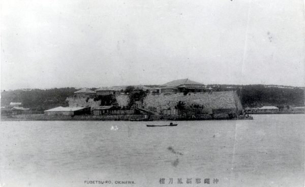
■Omono Gusuku
Omono Gusuku was built on a rocky outcropping located inside Naha Port. During the Golden Age of Trade, this place was a warehouse to store trading items. In the '30s of the Meiji Era, there was Ryoutei-Fugetsu-rou (a luxurious Japanese-style restaurant), after crossing the Kitameiji-Bridge, adjacent to Ounoyama.
■Utinda
This area is located in Kakinohana, facing Onoyama, There was a spring from top of the cliff, simulating a waterfall. Up until the 1930s, water seller boats under the cliff collected water in buckets and, carried them to Naha.
■Suraba
A shipyard was running since the feudal period of Ryukyu to later centuries; the shipyard was located on the sandbank in front of Kakinohana on the south shore of Naha Port. In 1881, a prison was built there. There was also Chinpe-utaki (Chinpe worship place) located on the east side of the sandbank, Today, Suraba has become part of the military port.
■Sumiyoshi
Sumiyoshi was a name of Naha port south shore area. The name originated from Shumiyoshi, a shrine in the area, locate midway on small hill. The hill a had beautiful pine tree forest and famous spot for moon watching.
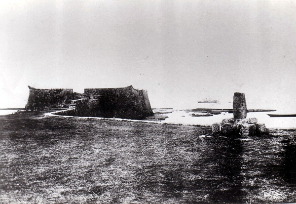
■Yarazamui Gusuku
Yarazamui Gusuku is located in Jousai at Naha Port's south shore and was established in 1554, the same year Yarazamui Gusuku was built to protect the port. After the war, Yarazamui Gusuku was removed because of port construction; then it was replaced, becoming a part of the pier.