Gajanbira
History
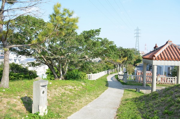
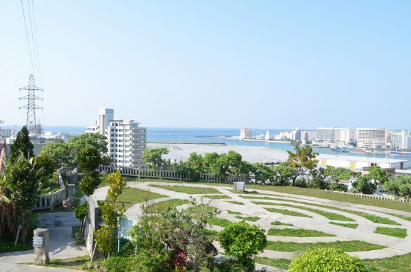
Gajanbira is the slope leading from Naha’s Kakinohana to the Oroku-Ashimine. The name also refers to the entire area around the slope.
Basic information
- Address
- 901-0155 1 Kanagusuku Naha Okinawa At Gajanbira Park
- Business hours
- Nothing in particular
- Close day
- Nothing in particular
- Charge
- Free
- Parking
- None
- Access information
- Take the "Yui Rail" from Naha Airport. Get off at Onoyama station. About a 20-minute walk.
By bus, get off at the Kanagusuku bus stop. A 10-minute walk away.
Additional Information
- Academic information
- Gajanbira is the slope leading from Naha’s Kakinohana to the Oroku-Ashimine area. The name also refers to the entire area around the slope.
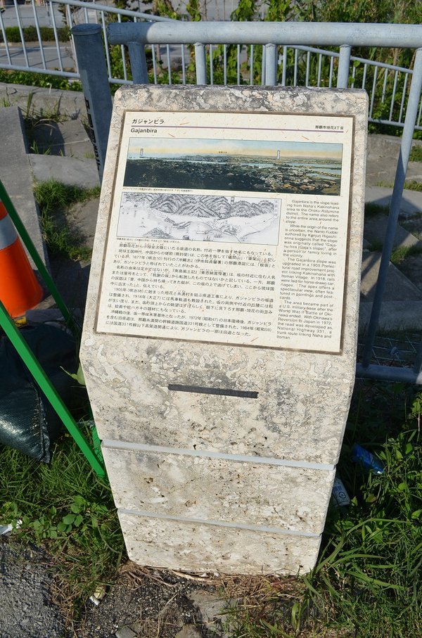
Chinese envoys recorded this area as "Gimayama","hikkazan" in Ryuku kingdom era. However, it was called "Gajan-bira" (gajan=mosquito) in the record found in Naha port map of "Okinawa-si"(author:Sadaka Iseji), a book issued, in 1877. (the 10th year of Meiji era) The origin of name is unknown; however "Nantou-fuudo-ki" (South islands climates journal, author: Nakajyun Higashionna) said that he guessed the origin of Gajan-bira was changed from "Gajanuhira"(Gaja's slope, Gaja is common surname in Okinawa), and the name borrowed someone's name or a house name in the neighbourhood. Naha folklore gives an alternate explanation: "Long time ago, one mosquito escaped and was brought back from China. And then mosquitoes spread out all over the Ryukyu."
In 1905 (the 38th year of Meiji era), Prefectural road construction to connect Kakinohana and Itoman began, and Gajan bira was maintained. In 1918 (the 7th year of Taisho era), a carriage drive had been built. - Quote
- Naha City Museum of History