Minchira Utaki
Historic sites
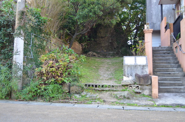
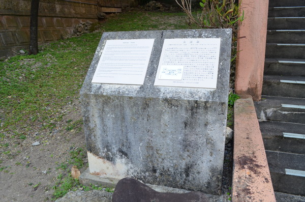
Minchira Utaki is located at the south of the site of Chuzan-mon Gate, which used to stand at the west end of Aijou Ufumichi Street extending from the Kankai-mon Gate of Shuri Castle toward the west. It is commonly known as “Minchira Utaki.” On “Shuri Kochizu” (the old map of Shuri), it was shown in another Chinese character, which is described at the front shrine.
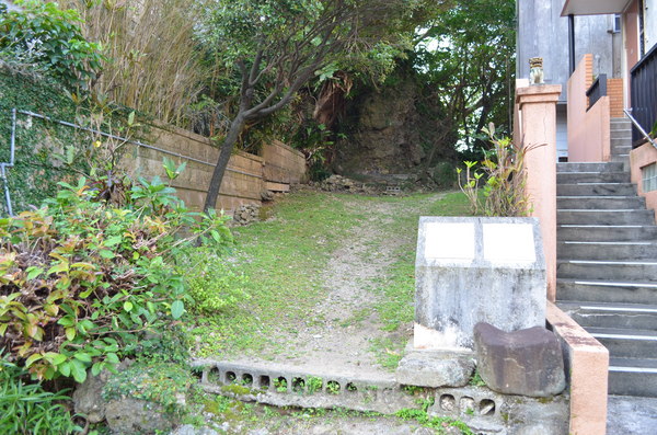
Presently the utaki ground has been divided into six areas, where private houses are built. Among such a crowded place, the rock at the udun still remains.
Basic information
- Address
- 903-0826 5 1-4-4 Samukawa Shuri Naha Okinawa
- TEL
- 098-917-3501 (English is not supported) Municipal cultural property division of Naha city
- Business hours
- Nothing in particular
- Close day
- Nothing in particular
- Charge
- Free
- Parking
- None
- Access information
- A 3-minute walk from the Yamakawa bus stop.
Additional Information
- Academic information
- Cultural property(Municipal designated historical site)
Designated Date: March 20, 1998
Minchira Utaki is located at the south of the site of Chuzan-mon Gate, which used to stand at the west end of Aijou Ufumichi Street extending from the Kankai-mon Gate of Shuri Castle toward the west. It is commonly known as “Minchira Utaki.” On “Shuri Kochizu (the old map of Shuri), it was shown in another Chinese character, which is described at the front shrine. During the Ryukyu Kingdom period, Minchira Utaki was under the control of Makabe no Oomushirare (one of three great priestesses). According to the chronicles of Ryukyu, “Kyuyo,” in the article of the King Sho Shin rein, the haiden (offering hall) was built during the time of Prince Sho Sada (1662 to 1668) during the Koki period (1662 to 1722) the haiden was reconstructed by the money from Sishiden (residence for the prince) afterwards.
During the Ryukyu Kingdom period, the Okyakuya (visitors’ house), Ankoku-ji Temple, and the Tamaudun (royal mausoleum) were built, stretching from the utaki to the east. Chuzan-mon Gate was built on the big street in front of the utaki. Across the big street from the utaki, Sishiden (moved to Ufuchun-mura Village in 1875) and Ufumi-udun (second house for kings) were built, stretching through the neighborhood, making it a beautiful sight as the entrance of the kingdom.
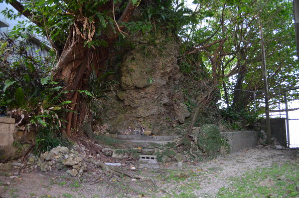
Until the beginning of the Showa era, the utaki was on a small hill that was about 250 tsubo (826sq m) with a gentle slope. The utaki was covered in grass with the strangely-shaped rock of about 5m (16ft) high rising up on the east. The north side of the rock touched a low pile of the stone gate, where an incense burner was set up. In front of the incense burner remained the foundation stone of the front shrine. The back slope of the strangely-shaped rock was covered agave and screw pine trees, which have grown leafy, long and slender on the west and the east.
Presently, the utaki ground has been divided into six areas, where private houses are built. Among such a crowded place, the rock at the udun still remains. - Quote
- Naha Board of Education Cultural Heritage Division (2007) "Naha Cultural Property" Naha Board of Education